RESOURCES
Resources: Annual Reports | Newsletters | Fact Sheets | Reports & Proposals | Links | Press Releases
Tonto National Forest
Planning to submit comments or attend a public meeting on the Tonto National Forest Revision Plan? This fact sheet will help you understand the topography and uniqueness that is at stake on the forest.
Find the full action alert here.
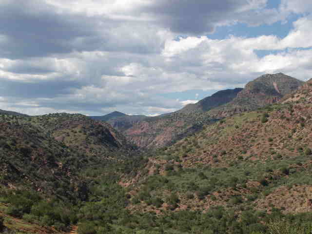
Size: 2,969,602 acres
Established: 1905
Range of elevation: 1,300 feet to 7,900 feet
Fifth largest National Forest in the US
Approximate Number of Annual Visitors: 5.8 million
Ranger Districts: Payson, Cave Creek, Pleasant Valley, Tonto Basin, Mesa, Globe
WATER
One of the primary purposes for establishing the Tonto National Forest in 1905 was to protect its watersheds around reservoirs.
Average acre-feet of water per year: 350,000.
There are six man-made reservoirs: Horseshoe, Bartlett, Theodore Roosevelt, Apache, Canyon, and Saguaro
Total storage capacity of the six reservoirs: 2 million acre-feet of water
Major Rivers: Verde and Salt
Wild and Scenic Rivers: Lower portion of the Verde River (This is the only Wild and Scenic river in Arizona, although legislation is
pending in Congress for designating Fossil Creek Wild and Scenic.)
FEDERAL WILDERNESS
Number of Wilderness Areas: 8
Wilderness Areas: Four Peaks, Hell’s Gate, Mazatzal, Salome, Salt River Canyon, Sierra Ancha, and Superstition
Total Wilderness Acreage: 589,300
ROADLESS AREAS
Number of Roadless Areas: 20
Roadless Areas: Pine Mountain Wilderness Contiguous (2), Mazatzal Wilderness Contiguous (3), Lime Creek, Hell’s Gate Wilderness Contiguous (2), Boulder, Goldfield, Black Cross, Horse Mesa, Salome Wilderness Contiguous, Sierra Ancha Wilderness Contiguous (5), Cherry Creek, and Picacho
Total Roadless Acreage: 169,857
WILDLIFE
The Tonto National Forests offers habitat for a diverse mix of mammals, reptile, amphibians, birds, and invertabrates.
Threatened and Endangered Species (Federal and State): 21
Common Animals Found on the Tonto: mountain lion, black bear, mule deer, elk, white tail deer, bobcat, opossum, ringtail cat, numerous snake species, bald eagle, goshawk, Mexican spotted owl, and numerous native fish species.
GRAZING
Number of Cattle Permitted to Graze: 26,000
Due to ongoing drought, the number of cattle permitted to graze on the forest has been lowered and will continue to be lowered as the drought persists.
MINING
Mineral Districts: 38
Mineral Mined (Current and Past): copper, gold, silver, lead, zinc, uranium, molybdenum, manganese, asbestos, mercury and many other metals and minerals.
TIMBER
Total Board Feet Removed per Year: 4,000,000
WILDFIRE
Average Number of Wildfires per Year (Over the Last Ten Years): 330
RECREATION
Miles of Non-Motorized Trails: Approximately 900
Total Miles of Roads: 4,270
Annual Road Maintenance Backlog: $2,904,070
Off Road Vehicle Areas: Bulldog Canyon and Rolls
|