
| Issue 1, Winter 2003 | |||||
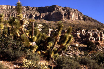
Plan Ahead! Out and About in ArizonaHikes, Walking Tours, and SightseeingThe following trails are recommended by the Sierra Club’s Wilderness Committee and are all relatively accessible from the Phoenix area. Please refer to an Arizona map for specific locations.
Contact Michelle Pulich, Wilderness Committee Chair, for more information about the trail conditions and hiking experiences in these wilderness areas: 480-820-9172, or by e-mail at flora22selva@yahoo.com.
Use the following chart for the Outings listed below:
JAN 10-12: Hassayampa River Canyon Wilderness Backpack. We will start by hiking down Slim Jim Canyon to its confluence with the Hassayampa and then follow upstream to the Deaf Joe Cabin. We then move onward to our camp, possibly at the mouth of Jesus Canyon. Day two will find us passing the Williams Ranch and the trailhead to the summit of Seal Mountain. Camp there is yet unknown. The last day will feature a short side hike to the waterfall in Oak Creek Canyon before exiting up Cherry Creek. For reservations, meeting time and place, call your leader, Jim Vaaler, at 602-553-8208. Phoenix. Sierra Club Rating: B FEB 9-10: Peeples Canyon Carcamp in the Arrastra Wilderness Area. (8 mi, 1000 ft. elevation change) Come see for yourself what this simmering controversy in this beautiful riparian canyon is all about. Do cattle and their "grazing improvements" belong in this wilderness area? Do these "improvements" need "improving" at the expense of the area’s outstanding wilderness values? Come along on this outing and be the judge for yourself. Issues of water rights, cattle grazing, wilderness values, riparian area protection, inholdings within wilderness areas, and other topics will be discussed around the evening campfire. For reservations, meeting time and place call your leader: Jim Vaaler at 602-553-8208. Phoenix. Sierra Club Rating: B FEB 10: Vekol Valley to Table Top Dayhike, Sonoran Desert National Monument and Table Top Wilderness Area (7 mi. RT, 2300 ft. elevation change) Let’s explore one of Arizona’s newest national monuments. Awaiting us at the summit will be a 40- acre island of desert grassland with a panoramic view of nearby rugged peaks. Call David Martin 795-9159, or email deugenemartin@yahoo.com. Tucson. Sierra Club Rating: B
MAR 21-23: Alamo Canyon Backpack, Organ Pipe National Monument (4 mi. RT, little elevation change/12 mi. RT, 2400 ft. elevation change) We will spend a few days at a primitive campsite far away from the main RV campsite near the north end of the monument. One day will hike cross-country to the top of Ajo Mountain and another day we’ll tackle a short hike along Alamo Wash. If we have good rains this winter, there may be a spectacular wildflower show across this remote Sonoran desert. The cost, in addition to sharing driving expenses, will be a $6/vehicle entrance fee, plus $5/site/night. There are 5 people/site allowed and a total of 4 sites available on a first come, first serve basis. Call David Martin 795-9159, or email deugenemartin@yahoo.com. Tucson. Sierra Club Rating: B/C APR 17-20: Backpack S. Bass Trail-Tonto Trail-Serpentine Canyon, “The Jewels.” (29 mi.+ RT, 4,000’+ elevation gain). The area of the Tonto plateau in Grand Canyon from S. Bass to Boucher is called “The Jewels” because of the names of the side canyons in that area: ruby, turquoise, agate, etc. We will leave Grand Canyon Village very early Thursday morning and drive two hours to the S. Bass trailhead. Then we will hike down the S. Bass trail and then east on the Tonto trail to at least its junction with Serpentine Canyon (9.7 mi.). We will set up our base camp near Serpentine or Turquoise canyons dependent on water availability. From there we will do day hikes east on the Tonto trail and explore the nearby side canyons and routes to the river. On Saturday, we will camp near the S. Bass trail to exit by Sunday afternoon (5.9 mi). In my 25 years of hiking and backpacking the Grand Canyon, this area strikes me as the most beautiful I have seen so far. High-clearance vehicle necessary, but high-clearance 4wd even better. $15 park backcountry fee payable in advance. Be prepared to contribute toward $25 fee to cross Havasupai land if requested. Limit of 5 participants plus leader. Extra water containers mandatory. For more info and registration contact the leader: Bob Audretsch, (928)638-2077 before 9 p.m., but e-mail preferred: bob41@grand-canyon.az.us. Grand Canyon. Sierra Club Rating: A Inventories, Meetings, and Wilderness Projects
Sky Island RegionPlease contact the Sky Island Alliance office at (520) 624-7080 or trevor@skyislandalliance.org if you are interested in volunteering for any of the following events. January 11th. Wildlife Tracking at the Audubon Research Ranch. We will be tracking lion, bear, coati, and other mammals in these beautiful rolling grasslands. No experience necessary. Leaving Tucson at 6:30 AM and returning by mid-afternoon. 1.25 hours from Tucson. January 17 - 19. Needles Eye Wilderness Inventory. Join the Sky Island Alliance in parts unknown! Slicing through the Mescal Mountain Range, the Gila River, enters 3 canyon segments with 1,000-foot walls known as the Needle's Eye. A deep, entangled riparian zone covers the narrow river channel, forming the southern boundary of this area. Several small slickrock canyons bisect the area, and wind to the Gila River. 3.5 hours from Tucson. February 7 - 9. Gila Box/Turtle Mountain Inventory. Join the Sky Island Alliance in one of the most gorgeous areas of central Arizona. Birds galore! Flowing Water! Great Wilderness potential! Need we say more? 2.5 hours from Tucson. February 21 - 23. Gila Mountains Roads Inventory. These remote mountains northwest of Safford contain some of the roughest country in Arizona. We’ll be focusing most of our road and ecological surveys around the existing Daytime Wilderness study Area. 2.5 hours from Tucson.
Road Closure and Restoration Project. Get your hands dirty and play a direct role in improving the ecological health of your public lands! Contact Matt at matt@skyislandalliance.org for more info. The Sky Island Alliance will also be hosting two Riparian Inventory and Monitoring Training Programs in April and May—stay tuned! If you are interested in volunteering to assess riparian areas and look for riparian animals, please contact Trevor Hare at 520-624-7080 or trevor@skyislandalliance.org. Western Deserts RegionPlease contact the Western Desert Regional Office for more information about the following events and volunteer opportunities. Jay Krienitz, 928-717-6076, or jkrienitz@msn.com. Help us craft an ecologically-sound management plan for Lake Havasu! The Lake Havasu BLM Field Office will be holding public meetings very soon—most likely in late February—to discuss alternatives in their land use planning process. The office is asking the public to submit recommendations for managing the area by March 24, 2003. Contact Jill Miller-Allert, Wilderness Coordinator, Lake Havasu Field Office, at (928) 505-1204 for more information about dates, times, and places for the upcoming meetings. Click here to fill out a personal recommendation to submit to the BLM (PDF, 155K). Come out and get dirty! Volunteer to do a wilderness inventory around Lake Havasu with the Western Desert Regional team. You can help AWC catalog resources and land features to develop wilderness area and wild and scenic river alternatives for the coming Lake Havasu Land Management planning process. The plan and will need lots of helping hands and wilderness adopters to gather data, as AWC will submit a final wilderness proposal sometime in late March. Contact Jay Krienitz to volunteer and get more information! jkrienitz@msn.com, or (928)-717-6076. Grand Canyon RegionPlease contact the Grand Canyon Regional Office for more information about the events listed below. Kim Crumbo, kcrumbo@grand.canyon.az.us, or (928) 638-2304. Be a River Advocate. The National Park Service will commence a series of meetings this spring to begin gathering public feedback on management of the Colorado River. This is an important and long-overdue phase of planning that will ensure adequate protection for the magnificent wilderness characteristics and experiences found along the Colorado River. You can help! Click here for dates, times, and meeting places, or contact Kim Crumbo, kcrumbo@grand.canyon.az.us, or (928) 638-2304 for more information.
South Central RegionPlease contact the South Central Regional Office for more information about the events listed below. Jason Williams, jwilliams@prescott.edu, or (928) 717-6076. Train to Adopt a Wilderness! You can become a wilderness adopter with the AWC and learn how to gather data on potential wilderness features. Attend one of these trainings to get started: Saturday, March 29th, or Saturday, April 26th. Contact Jason Williams for specific times and places, jwilliams@prescott.edu, or (928) 717-6076. |
|
||||
 March 7 - 9.
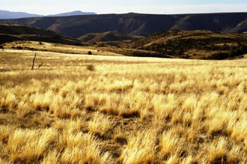

 Make your late winter and early spring outdoor plans here! Visit our comprehensive list of day outings, inventory trips, meetings, and upcoming AWC events for the latest in wilderness “happenings” around the state.
